
Severe weather moved through the region Monday evening bringing with it large hail, strong winds and a lot of rain.
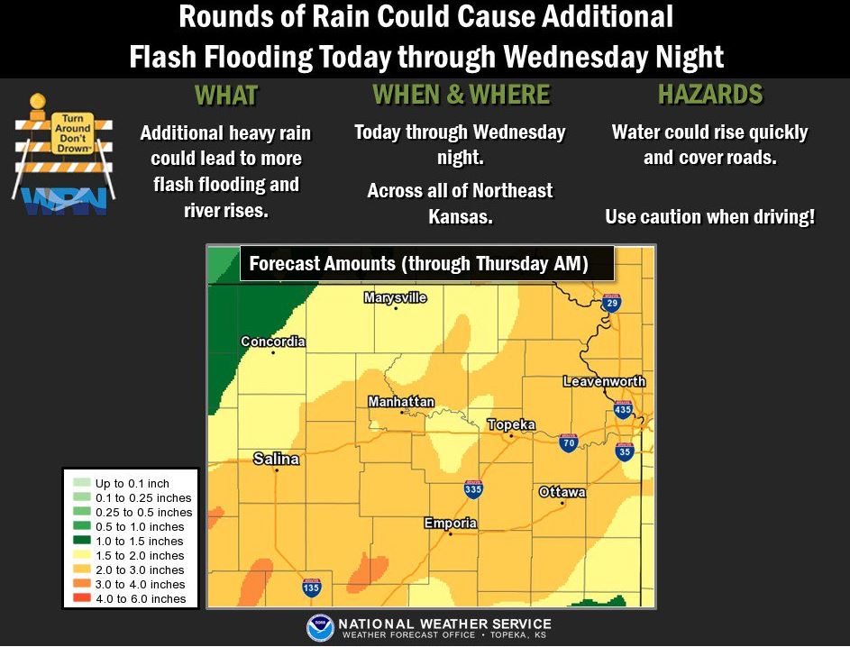
Flash flood warnings were issued overnight for the Manhattan area which have since been lifted. A flood watch continues through Wednesday night. A flood warning for Fancy Creek continues until Wednesday afternoon. At 7:15 a.m., the creek was staged at 17 feet. Flood stage is 16 feet. Riley County Emergency Manager Pat Collins tells KMAN the concern now is with flooding, especially along areas like Wildcat Creek.
Collins – proactive
Rainfall totals: as of 7 a.m. Tuesday
*KMAN Studios – 1.6 inches
*Timber Creek III – 1.10 inches overnight
*Near the spillway on Pottawatomie County side of Tuttle Creek Lake – 2.02 inches the last 24 hours
*North of Manhattan Regional Airport – 2 inches (1.2″ yesterday evening and 0.8″ overnight)
*4th and Bluemont – 1.9 inches in the last 24 hours
*Stagg Hill area – 1 inch
*Leonardville – 1.5 inches
Last night’s storm brought spotter reports of ping pong ball sized hail southwest of Junction City. Dime to quarter-sized hail fell near Milford Dam and Grandview Plaza. Riley County Emergency Management reported a barn blown down near US-77 and University Park Road north of Riley shortly before 5 p.m. Wind gusts of 60 to 70 mph were reported with these storms.
Another round of storms is expected today. The National Weather Service says the best chance for strong to severe thunderstorms capable of producing large hail and strong winds will be after 1 p.m.
The post First round of storms roll through Manhattan area, flooding concerns continue through midweek appeared first on News Radio KMAN.