NWS Storm Prediction Center graphic – May 28, 2019
Another significant threat for severe weather is ramping up this afternoon and evening across the state.
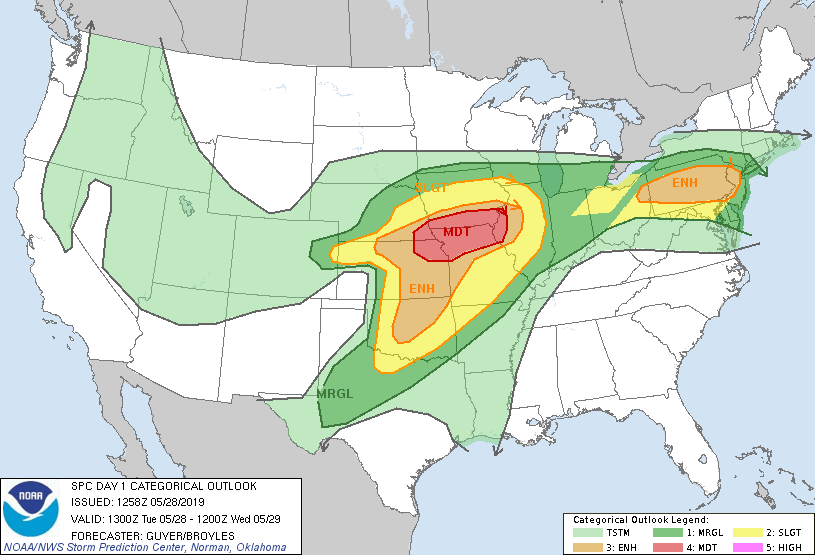
The National Weather Service says a powerful upper level system will move northeast across the Plains. Thunderstorms will develop along a cold front across north central and central Kansas this afternoon. As a result, most of the Manhattan is an enhanced risk for severe weather development. Pottawatomie and extreme northeast Riley County are listed in a moderate risk for severe weather. Up to golf ball sized hail, 60 to 70 mph wind gusts, heavy rainfall and tornadoes will all be possible with these storms.
Flooding will continue to also be a concern with the possibility of heavy rains at times. The storms should move through the area in the mid and late evening hours.
The post Manhattan area in an enhanced to moderate risk for severe storms Tuesday appeared first on News Radio KMAN.