
National Weather Service graphic
MANHATTAN — A shift in the weather pattern this week will bring the threat for severe weather Monday and continued heavy rainfall and storm chances through Wednesday.
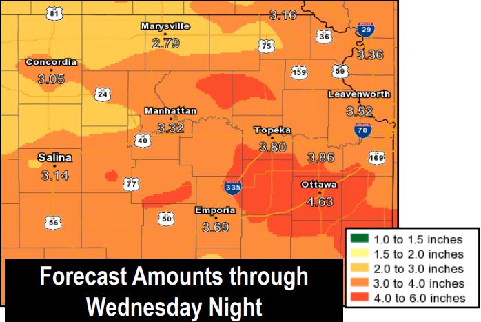
The National Weather Service in Topeka has issued a Flash Flood Watch for all of northeastern Kansas through Wednesday night including Riley, Pottawatomie and Geary counties. Rainfall amounts of 2-3 inches are possible across the area with some amounts as high as 5 inches also possible. Saturated soils will likely contribute to rainfall runoff which could cause creeks, streams and rivers to rise quickly as well.
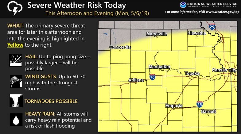
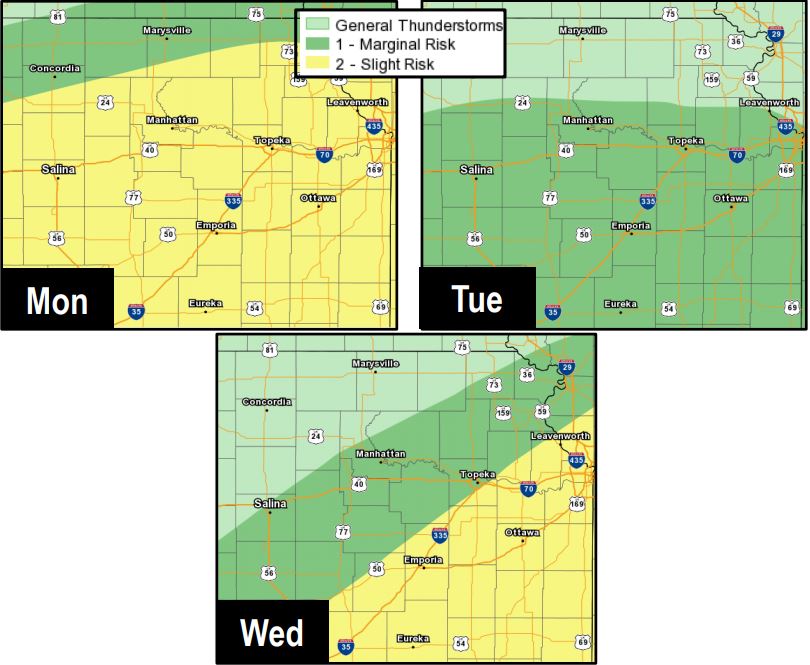
A slight risk of severe weather also exists for Monday afternoon into the evening with all hazards possible. That includes up to ping pong size and possibly larger hail possible along with up to 60-70 mph wind gusts with the strongest storms. The National Weather Service says tornadoes will be a threat both today and possibly Wednesday. Tuesday will be mainly a hail and wind risk.
Rain and storm chances continue for the Manhattan area through midweek.
National Weather Service graphic
National Weather Service graphic
The post Slight risk for severe weather Monday; Flash Flood Watch posted through Wednesday appeared first on News Radio KMAN.