
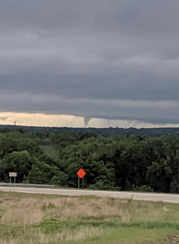
Photo of a tornado taken north of Ogden Tuesday evening. Photo courtesy Aaron Estabrook
Severe weather pushed through the region Tuesday evening bringing tornadoes, hail and some brief heavy rains.
Activity began around 4:30 p.m. when a cell developed in Geary County, then moved through Fort Riley, west of Manhattan and into northern parts of Riley and Pottawatomie counties. Tornado sirens were sounded in the City of Manhattan, but no reports of damage were reported in and around Riley County.
The Geary County Sheriff’s Office reported a touch down of the tornado north of Old Hwy 40 at the county line. It traveled northwest, staying south of Milford Lake and west of Junction City before crossing over onto Fort Riley. Damage observed has been minor tree damage, along with light shingle damage and the destruction of a small metal shed. No injuries have been reported at this time.
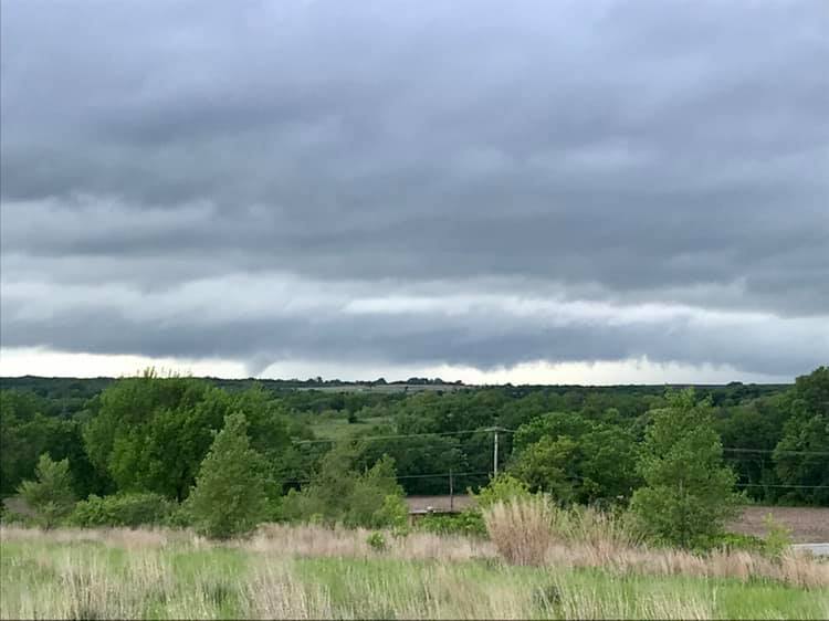
Another image of the above tornado shows it was rain wrapped as it pushed through Geary and Riley counties. This is looking north from Skyview Road. Photo by Aaron Estabrook.
Pea to quarter sized hail was reported with these storms, with some reports of up to half-dollar sized hail. Further east, tornadoes were reported to have touched down near Rossville and the Pottawatomi Reservation in Shawnee and Jackson counties respectively. Damage from multiple tornadoes in the Nemaha County area were also reported.
The post Tornadoes, severe storms rip through northeast Kansas appeared first on News Radio KMAN.